
Thomas Yocum
North Carolina has few symbols like her lighthouses. From the majestic coastal towers at Cape Hatteras, Bodie Island, Currituck Beach and Cape Lookout to the more demure lights at Ocracoke, Bald Head Island and Price's Creek, the eight sentinels of our shores are among the best-known and most-loved treasures. But the lighthouses still standing along the North Carolina coast are but a few of the beacons that once marked the nighttime landscape. Nearly thirty other lighthouses and light vessels as well as dozens of smaller aids to navigation that once marked the state's coastline have been lost to time, neglect and warfare.
Lighthouses played a significant role in the early development of eastern North Carolina. Unlike her colonial counterparts, the state lacked a safe deepwater harbor. Instead, ships had to negotiate the constantly changing inlets and a maze of shifting shoals and sandbars. As early as 1715, state officials had already begun to mark the channels at Ocracoke Inlet in an effort to improve commerce, but it was clear much more needed to be done.
Shortly after the American Revolution, the N.C. General Assembly moved to construct lighthouses marking the inlet at Ocracoke and the mouth of the Cape Fear River, the two principal ports at the time. In 1789, work began on a lighthouse at Smith Island, also known as Bald Head Island, at the mouth of the river, and plans were also underway to build an Ocracoke lighthouse. The same year, the federal government assumed control of all maritime aids to navigation in the country. North Carolina officials readily agreed to pass to another governing body the daunting task of marking more than three hundred miles of ocean coastline and thousands of miles of inland shores. Building lighthouses was an expensive proposition for new states and the problems soon became a federal concern.
Federal officials finished the Bald Head light in 1795 and the light at Ocracoke Inlet in 1798. Work was also underway to mark the treacherous waters off Cape Hatteras, although the Hatteras tower would not be lighted until 1803. Despite the best intentions of federal engineers, all three lighthouses were disappointments. The beacons were deemed too weak to be of much use to mariners, especially during bad weather when they were most needed. Fires sparked by the open flame of whale oil lanterns were common, forcing unscheduled outages and increasing the risk to ship captains who assumed the lights would be displayed.
Each of the three first lights, however, soon faced even more serious problems. It was soon apparent the Bald Head Lighthouse had been built too close to the island's shore. By 1810,officials were required to place wooden breakwaters near the base of the brick lighthouse in an effort to stem the tide, but to no avail. The lights at Ocracoke and Hatteras fared little better. Winds began to erode the sandhill on which the Hatteras tower was built almost as soon as it was completed, and the channel the Ocracoke light was designed to mark was slowly migrating away from the tower, threatening to render it useless.
Frustrated by the initial attempts at safeguarding the Carolina coast, the U.S. Congress appropriated funding for a survey of the state's shorelines in 1806 after a committee appointed to study the problem reported "it is supposed there is no part of the American coast where vessels are more exposed to shipwreck then they are passing along the shores of North Carolina..." In the same year, the federal government also began construction of a lighthouse at Cape Lookout; by the advent of the War of 1812, it had completed its designation of the three most prominent points along the coast.
In 1813, attention again turned to problems facing the Carolina lighthouses. Erosion had become so bad at Bald Head light that it was decided the tower should be dismantled before it fell down. Bricks from the first tower were used to build the second Bald Head Lighthouse which was lighted in 1817 and still stands as the state's oldest. At Ocracoke, the problem of what to do about the increasingly obsolete Shell Castle light was solved by an 1818 lightning strike that destroyed both the lighthouse and the keeper's quarters. After a lightship stationed in the inlet proved ineffective, the current Ocracoke Lighthouse was completed in 1823.
With new lighthouses at both Bald Head and Ocracoke, and coastal lights at Cape Lookout and Cape Hatteras, attention turned next to the broad sounds and rivers of eastern North Carolina. Beginning in the 1820s, a series of lightships were placed at key locations. The lights marked the mouths of major rivers such as the Neuse, Pamlico, Pasquotank, and Roanoke, and significant shoals such as Long Shoal near Engelhard, Harbor Island between Pamlico and Core sounds, and Nine-Foot Shoal near Ocracoke.
By the mid-1830s, a total of nine lightships and two small lighthouses -- at Pamlico Point at the mouth of the Pamlico River near Hobucken and Roanoke Marshes near Roanoke Island -- had been added to the navigation charts. The lightships were typically staffed with a four-man crew consisting of a captain, first mate, and two crewmen. The ships displayed lights ranging in height from twenty-eight feet to forty-six feet above the water and were painted to make them more visible during the day. Contemporary reports describe the variety of colors used to paint the ships including red, yellow, straw, white and gray.
With the principal promontories and navigation routes marked, federal officials next turned their attention to other problem areas. The portion of the Outer Banks from Cape Hatteras north to the Virginia border lacked any navigational aids. In 1836, a survey report recommended construction of a lighthouse on Bodie Island, south of Nags Head. Although it was agreed a light was needed, it took more than ten years before the tower was erected in 1848. Even then the lighthouse was beset by problems. Lacking a proper foundation, the tower soon began to tilt, fouling the delicate mechanism that rotated the beacon and rendering the light almost useless within ten years.
The 1850s witnessed even greater attention on North Carolina's lighthouses. Virtually all of the coastal lights were refitted with state-of-the-art Fresnel lenses and painted to increase their visibility. Two of the coastal towers -- Cape Lookout and Bodie Island -- were replaced with new lighthouses, and the Cape Hatteras light was boosted from ninety to one hundred and fifty feet above the ground. New, smaller lighthouses were erected on Beacon Island near Ocracoke and on Bogue Banks at Fort Macon near Beaufort
. The Cape Fear River also was marked, answering decades of complaints from Wilmington merchants for a safer passage along the twenty-five mile route to the sea. Lights were added at Oak Island, Price's Creek, Orton's Point, Campbell's Island, and at Upper Jetty, just south of Wilmington. A lightship also was placed at Horseshoe Shoal.
A new type of light was also incorporated to replace the aging lightships. The screw-pile lighthouse, which relied on sturdy iron pilings that could be threaded into the bottom of the sound like huge screws to form a foundation, began to appear along the Carolina coast. The screw-pile lights, which had been perfected by a blind British engineer two decades before, became immensely popular among American planners. An 1859 directive from the Lighthouse Board called for the substitution of the cheaper and more durable screw-pile lights to replace lightships.
By the end of the 1850s, North Carolina's navigation system was at its peak. Tall, coastal towers guided ocean-going ships, while smaller interior lighthouses, lightships, and screw-pile lights guided traffic along the sounds and rivers. But the dawn of the Civil War turned into the twilight of the early Tar Heel lights. The winds of war would soon unravel more than a half-century of effort as the lights became strategic objectives.
The Union naval blockade of the South forced Confederate planners to extinguish and often destroy the lighthouses they had lobbied so hard for in the halls of Congress. The lights did little to benefit the Southern cause and destroying them helped hinder Union commercial and military traffic. The effects on the beacons were devastating. Confederate forces destroyed the lighthouse at Bodie Island and on Bogue Banks, along with most of the lights along the Cape Fear River. They removed or vandalized the Fresnel lenses from Cape Hatteras to Cape Fear and damaged or destroyed all of the lightships. Although Union engineers were able to replace the lenses, the damage was done. Gone was a generation of lights and lightships. Soon to follow was the Cape Hatteras Lighthouse, which was so badly damaged by a half-century of wind erosion to its foundation that a replacement was erected in 1870 and the original 1803 tower destroyed.
Today, there is little evidence of the first lighthouse that once marked the North Carolina coast. A shell of Price's Creek Lighthouse is all that is left of the extensive system of lights along the Cape Fear River, and a single screw-pile light near Edenton is all that remains of the interior beacons. But the remainder of the first lights are gone -- victims of erosion, warfare and advancements in technology. In their place are the second- or even third-generation of lights to identify the Tar Heel shoreline. The small bright beacons that now flash across the night sky are just a fraction of what once was, when early lighthouses and lightships marked miles of liquid highway along the North Carolina coast.
About the Author: Thomas Yocum is an award-winning journalist who lives on Ocracoke Island. A frequent contributor to a variety of local and regional publications including Our State Magazine, Outer Banks Magazine and Business North Carolina Magazine, he also works as a correspondent for Reuters News Service and North Carolina Public Radio. He is co-author of two books: the 16th edition of the Insiders' Guide to the Outer Banks and Cape Hatteras: America's Lighthouse.
Yocum draws from a variety of experiences to create his own style of non-fiction writing. A former field archaeologist, paramedic, and professional ski instructor, he enjoys acquainting his readers with some of the more interesting but lesser known sides of the history and nature of the Outer Banks and the Carolina coast.

When you first catch sight of The Jolly Roger, you might be unsure exactly what to think of it. Since its conversion from a gas station/grocery store to a restaurant in 1972, The Jolly Roger has been anything but your ordinary Outer Banks...
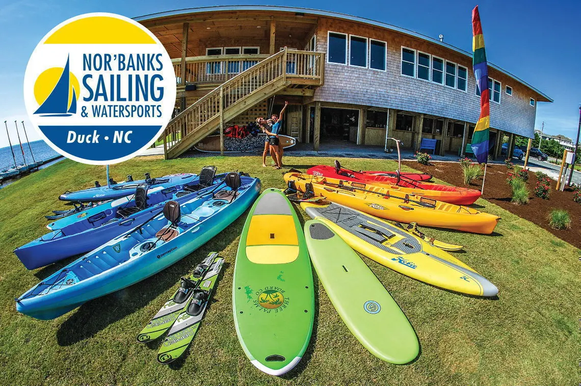
Nor'Banks Sailing & Watersports beautiful location and top-of-the-line equipment, together with a friendly and professional staff make it one of the premier water sports centers on the Outer Banks. Nor'Banks' sound front location has a huge...

Miller's Seafood & Steakhouse has been a favorite among locals and visitors for more forty years. Offering delicious southern cuisine for both breakfast and dinner in a casual family atmosphere infused with coastal flair, it's no wonder this...

The noted explorer, archaeologist, anthropologist, paleontologist, and part-time plumbing contractor from the University of Chicago, Professor Duffer A. Hacker, led two expeditions to the outer banks in the late 1920’s. The purpose of these...