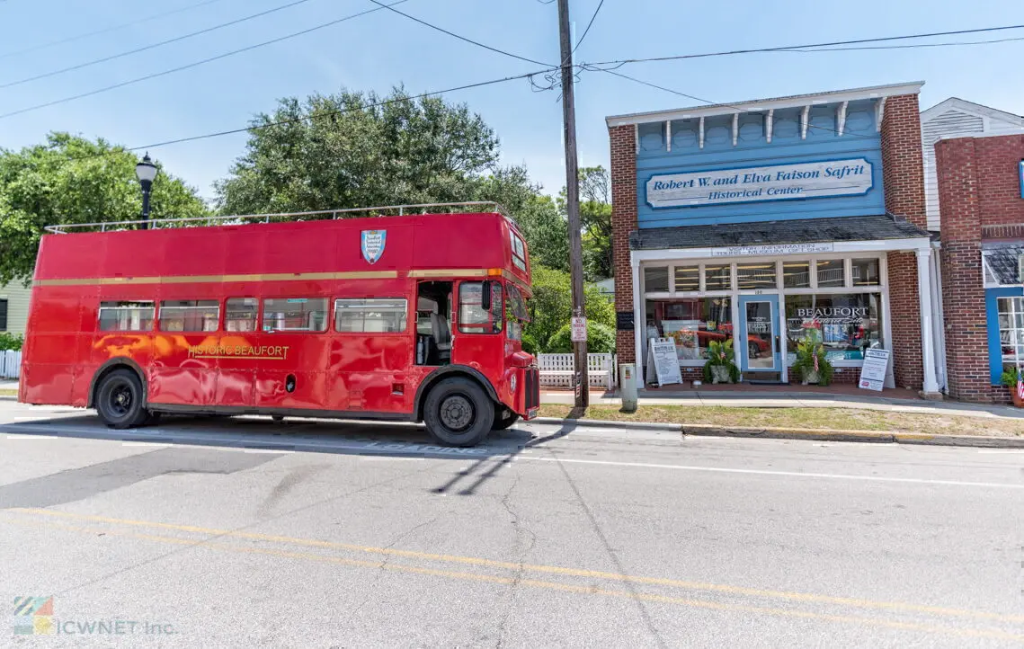

Perhaps no other region of coastal North Carolina remains as untouched and culturally intact as the low marshy area in eastern Carteret County known as "down east". The residents of down east have retained their simple lifestyle and even their own way of speaking for nearly 300 years, largely due to the remoteness of the region.
Waterfront communities with evocative names such as Stacy, Straits, Atlantic and Sea Level are nothing more than collections of homes, fishing businesses, small schools, and churches. There are no incorporated towns, and daily life revolves around the ebb and flow of the tide.
The area is home to the famed High Tider accent. The dialect is a remnant of Elizabethan English that was once spoken in colonial Carolina. Combined with a slow southern drawl, the dialect is indigenous to the lowland areas of North and South Carolina. Many linguists have come to the area to record and study this curious manner of speaking, which is in danger of being assimilated as the last of the old timers passes away.
Although there are no definite geographic boundaries to Down East, locals know that it "officially" begins on the east side of the North River. From there, a broad marshy peninsula extends northeastward, bounded by the Neuse River and the Pamlico Sound on the north and the cape lookout national seashore on the south and east.
The first settlers of this tidewater region were recipients of royal land grants in the early 1700s, and they made their living from the sea--as their descendants do today. One of the first down east places to be settled was Harker's Island, a narrow east-west island at the southern end of Core Sound. Originally home to a thriving band of Tuscarora Indians, the island is today a symbol of Carteret County's maritime heritage. Once accessible only by boat, the island wasn't connected to the mainland by bridge until 1941.
Today, the residents of Harker's Island have developed an attraction of their own, the Core Sound Waterfowl Museum & Heritage Center. Avid waterfowl hunters, the locals developed the art of wooden duck decoy carving over the centuries, and they proudly display their craft at the museum. Each year, they honor one of their own--the best of the best--at the Core Sound Decoy Festival.
The headquarters office for the cape lookout national seashore is also located on Harker's Island. A concessionaire offers daily ferry access in the summer months to the Seashore from the island.
At the northeastern tip of the down east peninsula, Cedar Island is the mainland terminus of Highway 12. Here motorists board one of the state supported ferries for the two-hour ride across Pamlico Sound to Ocracoke Island, where the Outer Banks leg of Highway 12 begins. Cedar Island National Wildlife Refuge is a well-preserved tidewater ecosystem, encompassing thousands of acres of marshlands and pine hammocks, as well as hundreds of species of wildlife. Visitors can get a unique glimpse of the area by horseback at the White Sands Motel and Horseback Rides, adjacent to the Cedar Island ferry offices.
Local legend has it that Cedar Island has a connection to the famed Lost Colony
of Roanoke. Many local historians believe that Cedar Island was where the colonists actually settled, not further north on Roanoke island as popularly believed. Occasional attempts at proving the theory are made difficult by the wild and inaccessible nature of the area.
Core Sound is North Carolina's shallowest and narrowest sound. Named for an indigenous tribe of Indians, the Coree, the sound separates the down east area from the low barrier islands of the cape lookout national seashore. The Seashore is the least visited of America's seashores and for good reason: it is accessible only by boat and accommodations are primitive at best.
But a visit is well worth it for those of the mind to rough it. The park includes about 29,000 acres of relatively undisturbed barrier island environment bounded on the north by Ocracoke Inlet and on the south by Beaufort Inlet. Three islands make up the seashore: North Core Banks, known as Portsmouth Island; South Core Banks, or Cape Lookout; and Shackleford Banks.
Camping is allowed anywhere in the Seashore, and four-wheel drive vehicles are allowed in non-posted areas. The National Park Service contracts with several concessions for ferry access. Algier Willis Fish Camps in Stacy is perhaps the most popular. The company owns and operates two fishing camps in the island. Rustic cabins on the beach are sold out to fishermen and other visitors months in advance. For other ferry access to the Seashore, contact the National Seashore offices.
Two deserted settlements in the Seashore are testimony to the fact that the maritime environment of coastal Carolina can often be harsh and unforgiving. On the north end of Core Banks at Ocracoke Inlet, Portsmouth Village was once the busiest seaport in North Carolina. Founded in 1753 to serve as a main port of entry for the colony, the village reached its heyday in the 1860s, with about 600 permanent residents and a constant stream of ships.
When Hatteras Inlet opened to the north, the village lost much of its traffic and the primary employer was the local lifesaving station. In 1953, a severe hurricane washed over the island, driving many more residents away. By the 1970s, the last remaining resident died, and the village was left uninhabited. Today, the town looks much as it did in the early 1900s. Many of its original buildings remain intact and maintained by the National Park Service, and the village was placed on the National Register of Historic Places in 1979. Ferry service to Portsmouth is available in Ocracoke Village in the summer months.
At the southern end of the Seashore, on Shackleford Banks, North Carolina's only whaling community, thrived in the 1800s. Diamond City lay in the shadow of the Cape Lookout Lighthouse on the east end of the island, and the lighthouse's diamond-shaped pattern lent the settlement its name. New England whaling vessels had discovered that the seas off the island were in the primary whale migration route as early as 1726, and by the 1850s, the locals of Diamond City had a booming whaling business in place. In 1896, at its apex, the town had 500 residents, a church, a post office, and a number of private dwellings.
That year and three years later, however, two monstrous hurricanes swept the island clean, and the town's residents had had enough. They disassembled their homes and floated them across the sound to Harker's Island, Morehead City, or Salter Path on Bogue Banks. By the turn of the century, Diamond City was but a memory.